
You are surely aware, dear Reader, that BIM in infrastructure is slightly different from the one used in construction. The disciplines, models, and objects in an infrastructure project have different characteristics than those in cubature structures (buildings). For instance, objects occurring in infrastructure projects have predominantly irregular shape (non-standard dimensions), considerable lengths of elements (even over 1 km, e.g. a layer of road foundation) and are located at significant distances from each other (e.g. light masts along the road, sewage drains)
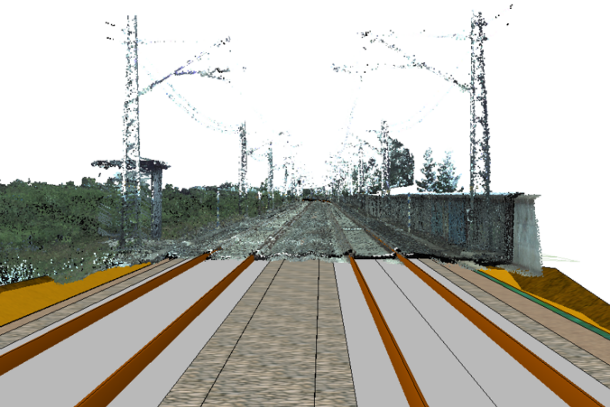
The modeling and presentation of the existing situation play a key role in infrastructure projects supported by BIM technology. The objects representing the existing situation occupy a large area and are of various detail levels. It is exactly the appropriate reflection of the terrain, layers in the ground and installations which are crucial for the accurate estimation of construction costs, or even for the identification of existing collisions of objects designed with existing objects. Inaccurate data may cause significant deviations in the reports of materials combinations and substantially increase the final costs of the project.
In order to better understand the way the virtual world of infrastructure is constructed, we are working on a series of articles, where we will explain all aspects of information modelling in infrastructure projects. For that reason, we will make use of Norwegian standards.
One of several studies supporting the implementation of the BIM model for infrastructure projects, developed in Norway, consists of the V770 textbook. It is the BIM guide created for Statens Vegvesen (the Norwegian equivalent of GDDKiA). The first version of the study was published in 2010. The textbook aimed to reduce costly modifications during the construction phase. Additionally, an attempt has been made to standardize the flow of information and procedures accompanying the creation of large amounts of digital data. Representatives of the investor, software developers, design companies, surveying, and construction companies operating in Norway were involved in the process of creating this handbook. The V770 handbook specifies the requirements for ordering, preparation, and delivery of data in road projects.
Due to the wide range of information contained in the above mentioned book, we divide the publication into six main parts. These are as follows:
-
Part 1: BIM objects in infrastructure projects,
-
Part 2: Base data for infrastructure projects,
-
Part 3: Model of the existing situation in infrastructure projects ,
-
Part 4: Discipline models in infrastructure projects,
-
Part 5: Multidisciplinary models,
-
Part 6: Presentations and visual models,
Part 1: BIM objects in infrastructure projects
The following publication clarifies the concepts related to BIM objects in road projects. The V770 handbook, which is the official standard supporting road infrastructure modelling in Norway, was used to prepare the text. One of the chapters in the book discusses the types of objects and their purpose. In the following text, we provide the most relevant information extracted from the above-mentioned section.
What do we call a BIM object?
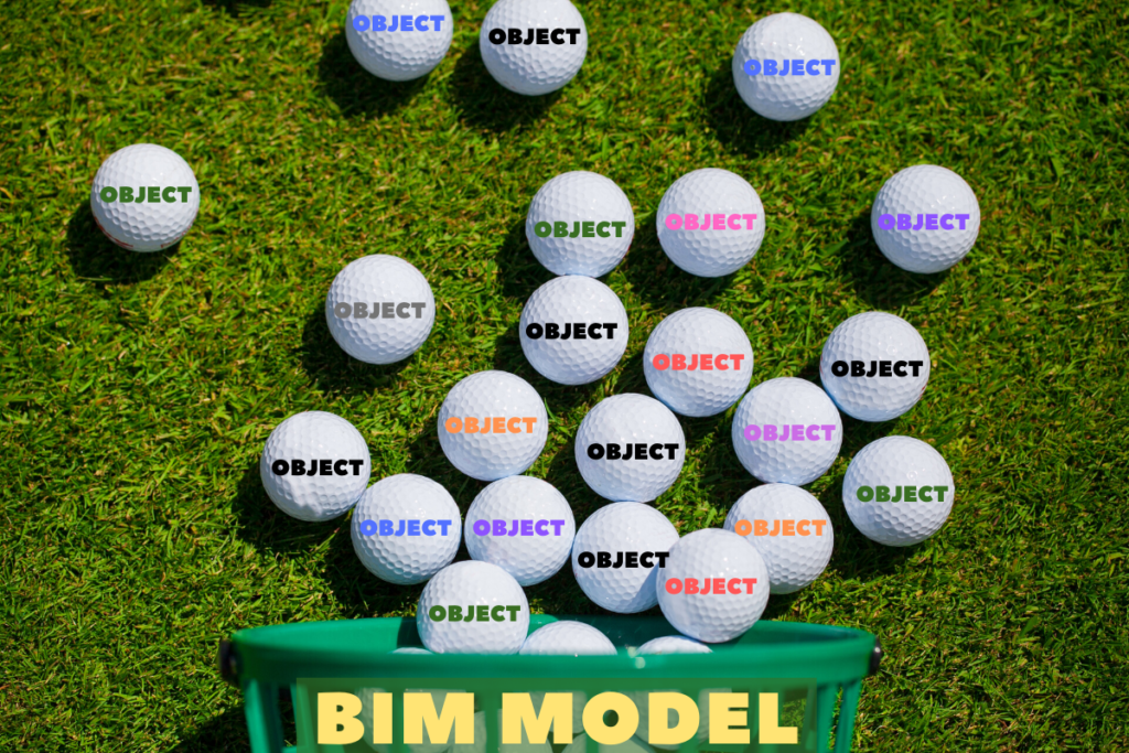
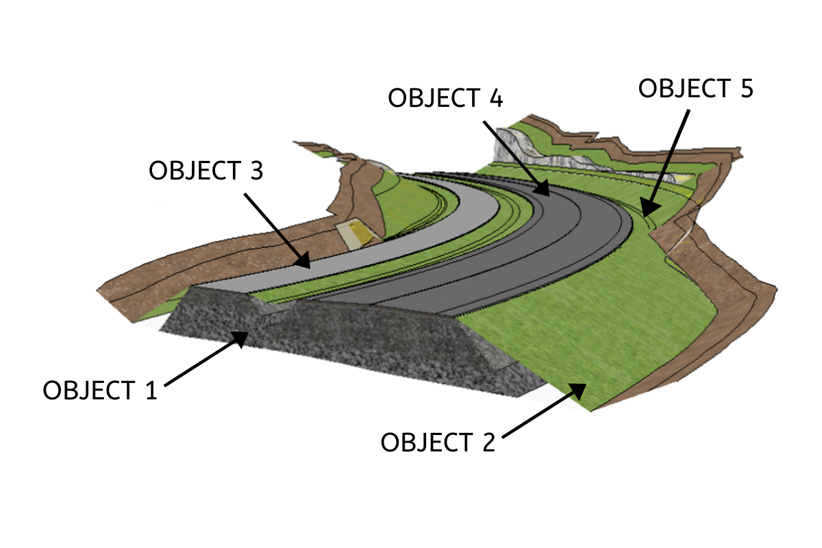
BIM models in infrastructure projects (e.g. road, tunnel, sewerage) include objects (e.g. roadway, manhole, foundation). Each object has a code (ID) and a name. Other information describing the object is called properties (e.g. material, volume, length, location).
What does the BIM object represent?
- Existing physical objects (e.g. fence, building, etc.),
- Existing conditions (e.g. city borders, safety zones),
- New physical objects which will be built or constructed temporarily (e.g. roadway),
- New conditions (e.g. speed limit zone),
- Objects applied in the design (e.g. centerline, various auxiliary objects, table),
- Terminal objects (products, results, setting-out data, geometry to the database).
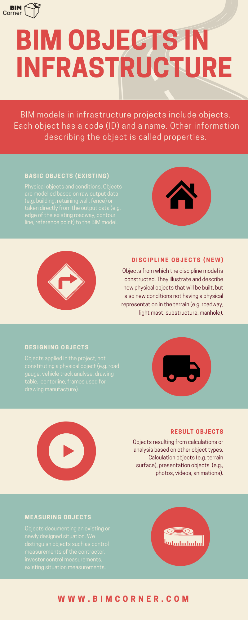
Types of objects in the BIM model
Basic Objects (existing) – physical objects and conditions. Objects are modelled based on raw output data (e.g. building, retaining wall, fence) or taken directly from the output data (e.g. edge of the existing roadway, contour line, reference point) to the BIM model.
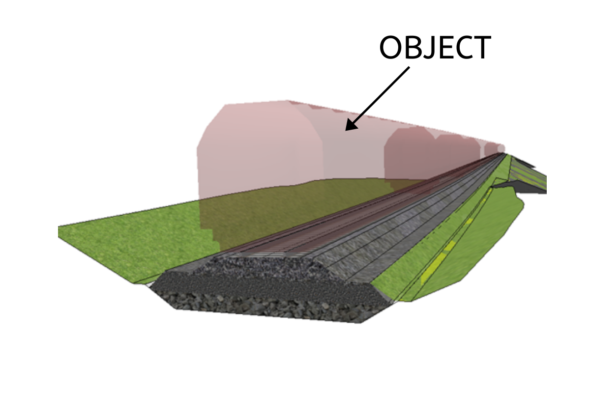
Discipline objects (new) – objects from which the discipline model is constructed. They illustrate and describe new physical objects that will be built, but also new conditions not having a physical representation in the terrain (e.g. roadway, light mast, substructure, manhole).
Design objects – objects applied in the project, not constituting a physical object (e.g. road gauge, vehicle track analysis, drawing table, centerline, frames used for drawing manufacture).
Result objects – objects resulting from calculations or analysis based on other object types.
- Calculation objects – objects resulting from calculation or analysis functions in software, e.g. TIN-model (terrain surface)
- Presentation objects – objects created as a result of rendering, video recording, or animation in software. (e.g., photos, videos, animations.)
Measuring objects – objects documenting an existing or newly designed situation.
- Control measurements of the contractor – objects documenting the work performed by the contractor; carried out by the contractor.
- Investor control measurements – objects documenting the work performed by the contractor; carried out by the investor.
- Existing situation measurements – objects documenting the existing situation.
Presentation of objects in BIM model
Objects can be either 2-dimensional (in the plan) or 3-dimensional (spatial).
Objects in the plan are represented by a surface, line, or point (symbol). These are mostly data coming from map compilations.
Spatial objects include height, width, depth and a reference point. Also, a three-dimensional object may have a volume and metadata containing additional information.
Object naming in the BIM model
In the BIM model, the object needs to have a proper naming according to the adopted standard. This simplifies the exchange of data between different databases and supports their interpretation. The Norwegian standards are known as SOSI (in Norwegian Samordnet Opplegg for Stedfestet Informasjon) and Prosseskoden R761/R762 (similar to CPV – Common Procurement Vocabulary). The SOSI standard categorizes objects into thematic groups (roads, railways, sewage systems). The SOSI format describes objects of existing situation (so-called map data), measurement objects. Process codes cover construction as well as operational and maintenance works. Both formats are used for exchanging data between public authorities and construction companies.
At the design stage, the nomenclature of newly designed objects depends on the type of software and the adopted structure described in BEP. In CAD programs, it is the layer describing the object. Typically, the layer unambiguously describes the type of object according to the adopted standard.
In programs using a 3D engine (modeling programs), the nomenclature may be different. An example of object-oriented software used in the infrastructure may be Trimble Quadri. Trimble Quadri bases the nomenclature and structure of objects based on an object library compliant with ISO 19100 standard. The library contains a set of objects (e.g. road edge, abutment, ditch), conditions (water reservoir, forest, agricultural land), and non-physical states (e.g. design speed, cant). Learn more about Trimble Quadri software in the next editions of the series.
BIM objects properties
Objects and conditions may possess properties. Such properties can include, for instance, geometric data describing shape, localization, but also such data as texture, material type, rail type, pipe type, year of manufacture. Object properties can be included in the layer name (in CAD programs), or as an attribute in modeling programs. The number of properties depends on the level of advancement of the project and the investor’s requirement.
Summary
We do hope this brief introduction to the series has allowed you to understand the nature of the objects and the main divisions that occur in the digital world of infrastructure. Please note that the division into objects simplifies the management of the BIM model and increases the transparency of understanding of infrastructure projects. It is, therefore, a good idea to employ software supporting infrastructure information modelling in infrastructure projects. In the subsequent editions of the series, we will focus more precisely on particular types of objects forming particular models (existing situation model, industry models).