In the article devoted to BIM formats, you could read that in a digital world of construction, we are dealing with many BIM file formats. We may distinguish both native and open files. Those files differ depending on their purpose and level of detail. They also contain various information as well as levels of information.
You have also learned, among other things, that IFC may be used in infrastructure projects. Such a file provides the ability to store a large amount of non-geometric information. And you know that the most important information lies in the last level (level 2).
The following article continues the series on data flow in infrastructure projects. In this part, I will introduce you to various BIM software supporting the creation, viewing, and editing of information in infrastructure projects.
BIM software for modeling information in infrastructure projects
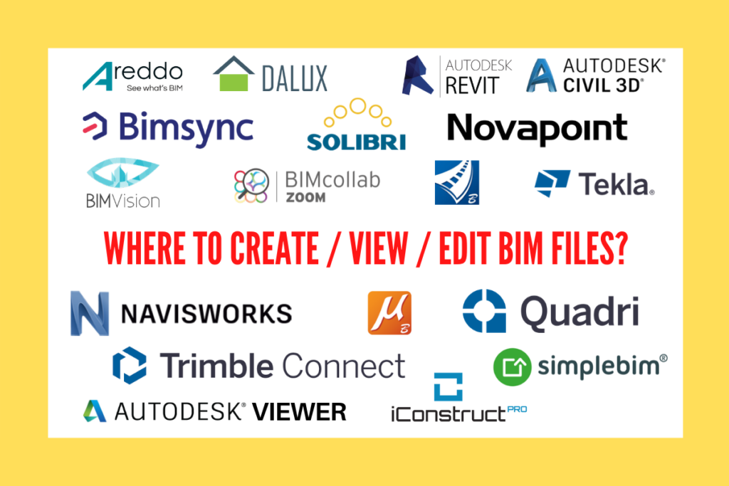
Currently, we may encounter a large number of BIM software supporting project processes. The most leading BIM software solutions in the infrastructure industry include Autodesk, Bentley, and Trimble. During my career, I was able to work with software provided by each of the mentioned companies. Since I am working on the Norwegian market (mainly Trimble solutions), I asked my colleagues to describe the tools they use in their daily work. Below you will find a list of the most commonly applied BIM solutions.
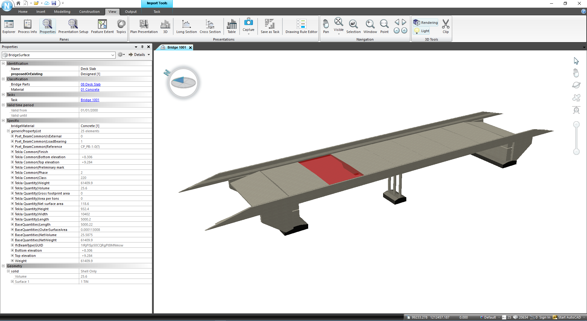
Trimble Novapoint is the most popular BIM software in Scandinavia for modeling communication infrastructure. It enables civil engineers for creating complex 3D models of roads, railways, sewage networks, tunnels, or bridges. With Novapoint it is also possible to model 3D terrain surfaces, 3D subsurface layers and 3D structures such as buildings, road signs, cables, etc. The models are created based on related objects. The software includes the Quadri object catalog, described here. The objects have geometric properties such as line, curve, plane, SOLID as well as non-geometric properties. Non-geometric properties include cant, speed, layer type, material, name, texture. All the information describing the discipline model is parameterized and simple to edit. Thanks to many available functions such as classifications, Pset allows you to add the properties to an object. SOLID and non-geometric information may be exported to an IFC file and various formats (LandXML, DWG, DWN).
Autodesk Civil 3D is BIM software supporting developed for infrastructure designers (roads, bridges, railways, networks, terrain, and water projects). It runs on the engine and AutoCAD’s interface. Its features combine the accuracy and ease of use of AutoCAD tools with intelligent and adaptive objects such as points, routing lines, surfaces, profiles, corridors, cross-sections, and plots. Each of the elements is equipped with characteristic information data. Civil 3D is an aggregator of various data types (CAD, GIS, SHP, DGN, LandXML, point clouds, etc.) equipped with dedicated tools for creating components of information model elements, project geolocation or automation. All objects in Civil 3D have properties (also called parameters) similar to other AutoCAD elements. Thus, they are dynamic and intelligent. Depending on the element category, these types of data can be freely modified and edited from the properties window.
Bentley OpenRoads Designer (ORD) is software originating from the American company Bentley – InRoads based on CAD – Microstation software. ORD is a stand-alone BIM program, being no longer just an overlay on Microstation, as it was with older versions. The main philosophy of the software derives from the principles of object-oriented programming, the parent-child relationship. Models are created by applying a normal section on the spatial axis. The body consists of linear elements and 3D components, being Mesh type objects. Geometric information such as length, surface or volume are generated automatically and permanently assigned to the individual objects. Any non-geometric information, such as BIM properties or items, can be freely added. A set of such properties may be created manually in the program or in a separate .XLSX file, which is directly uploaded to the ORD. The properties are either added manually or generated automatically while creating road corridors after being assigned to the Feature Definition – the styles describing how a given object looks and describes itself in different views (plan, profile, cross-section, 3D view). OpenRoads Designer allows you to export the entire body to IFC 4×2 format, containing a full range of both geometric and non-geometric information. It only contains the export feature, there is no possibility to modify any options.
Tekla is software widely implemented in BIM, mainly for modeling steel and reinforced concrete structures. With to Tekla Structures, it is possible to model a range of different structures, such as:
Bridges (beam, box, lattice, arched, cantilever, suspension and cable)
Underpasses, culverts
Retaining walls
The software allows creating models with the highest level of detail (e.g. modeling welds in steel structures). It offers the possibility of exporting files directly to the fabrication, CNC machines, and bar bending machines. Objects created in Tekla feature standard properties such as:
object type (column, beam, slab, spot footing)
profile (HEA, HEB, L, etc.),
material (steel, e.g. S235JR, S355JR or concrete C25/30, C40/50, etc.)
It is also possible to define individual profile types, materials, or databases (catalogs). Tekla offers an extension to model complex bridge shapes with different gradients – Tekla Bridge Creator (a tool allowing to load road/rail alignment in LandXML format). Furthermore, with a live link from Rhino Grasshopper, you can create parametric objects with very complex shapes and different construction alternatives in a short time.
AutodeskRevit is the most popular construction BIM modeling software in the world. It offers several modules dedicated to different specializations. These include Revit Structures for constructors, Revit Architecture for architects, as well as Revit MEP for sanitary, plumbing, and electrical engineers. Revit is mostly applied in infrastructure projects for modeling road structures such as bridges, footbridges, underpasses, culverts, tunnels, and retaining walls. In recent years, Autodesk has greatly improved the terrain modeling module, hence the software is also becoming increasingly popular among landscape architects. The program has a large number of modeling, model information management, data grouping, and model visualization features. It also gives the possibility to export to several different formats such as DWG, DGN, DWF, IFC, ODBC. With the free add-in for parametric modeling called Dynamo, Revit opens a whole new range of options. It allows you to create complex 3D models, fully parametrized smart 3D objects (called families in Revit) as well as to automate repetitive design activities.
BIM software for viewing information included in CAD/BIM files
In the above section, I discussed the most popular 3D modeling software in the infrastructure world. All these programs are capable of exporting a model to different formats. The next category focuses on BIM software allowing you to view BIM files containing geometric objects and non-geometric information. I will focus exclusively on the way the information contained in the files is viewed. Other features of the described BIM software are not covered here. For the analysis, I examine the IFC file as it contains a lot of non-geometric information.
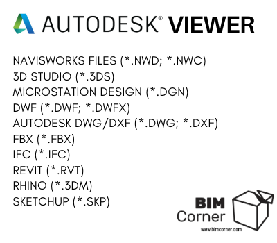
List of selected formats supported by Autodesk Viewer:
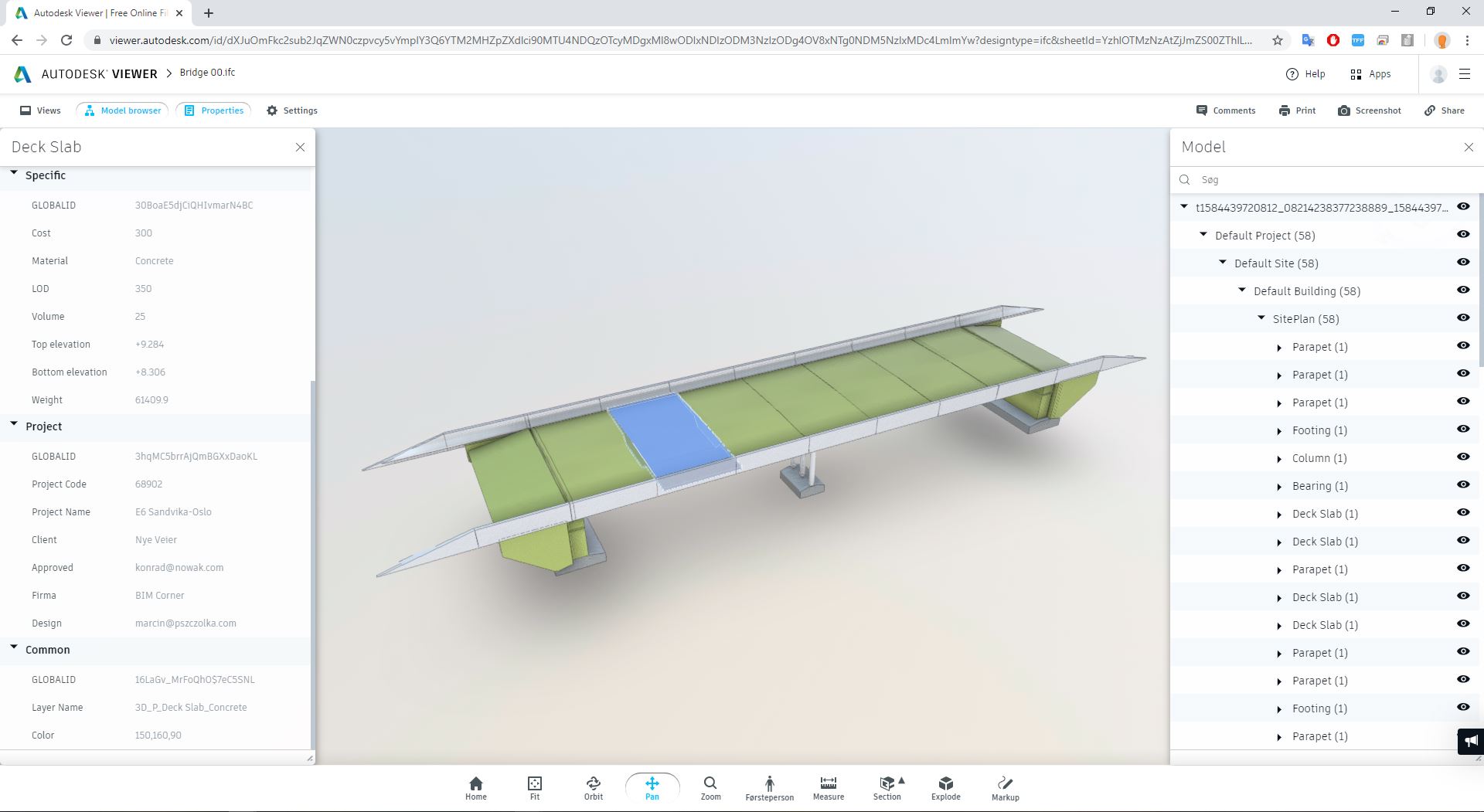
Autodesk Viewer is a free browser BIM software for viewing 3D models. The application allows you to view model content (model browser) and properties assigned to individual objects. Properties are presented tabularly in a dialog box. Moreover, the application offers several tools supporting the model view (Orbit, Pan, Zoom, Section, Explode). The software requires an account on the Autodesk website.
Autodesk Viewer
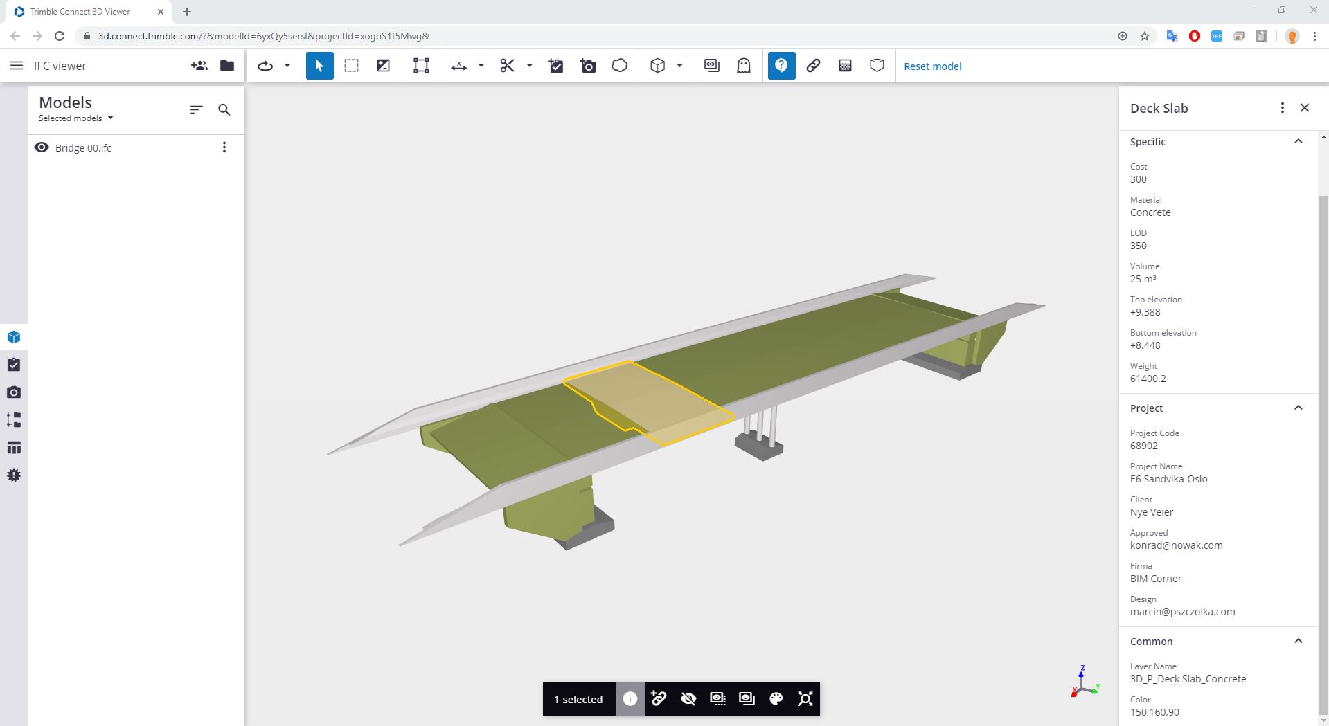
List of selected formats supported by the Trimble Connect
Trimble Connect is a free BIM software for individuals (paid version for companies). It is available in both browser and desktop versions (replacing Tekla BIMSight). The application allows viewing the 3D model from different perspectives. The application offers the possibility to adjust the camera (Rotate, Pan, Look around). After clicking on any object we can extract it, hide it, or change color. It is also possible to view non-geometric properties assigned to the object. The program provides the possibility of analyzing all data simultaneously (Data Table), grouping them and exporting to CSV files. The paid version allows you to add information to an object
Trimble Connect
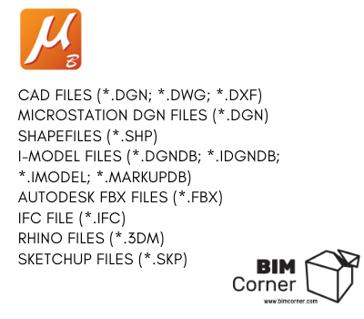
List of selected formats supported by Bentley Viewer:
Bentley Viewer is a free desktop application with a range of features to view and analyze the geometric model. The program includes many features known from MicroStation. The file views the 3D geometry contained in the IFC file, however, it does not provide information on non-geometric properties.
Bentley Viewer
List of selected formats supported by Navisworks
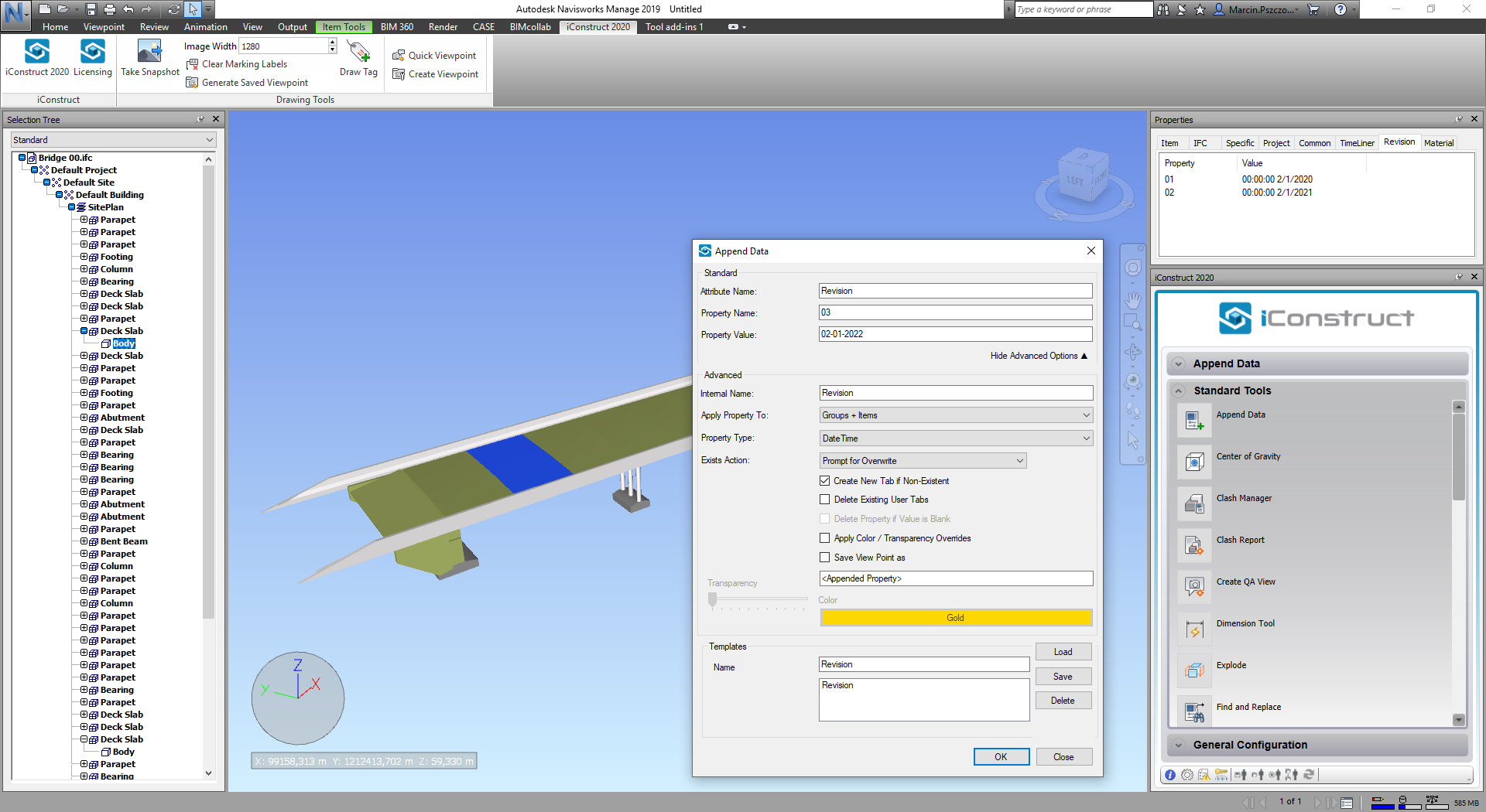
Navisworks is a paid desktop application ($880/year). The BIM software gives the possibility to view the model from different perspectives. Navisworks enables you f.ex. to move objects from 0,0,0 to 100,100,100. Also, Navisworks allows you to change the color of objects, add texture, or set the transparency of an object. You can isolate objects, search for and filter data, and create sets with the corresponding characteristics (e.g., all pipes with a diameter of 200 mm). In the properties window, you have an option to preview information assigned to an object.
Autodesk Navisworks
BIM software for viewing the information included in the IFC
There are many BIM programs on the market, both paid and free, supporting the view of IFC files. In the following part of the article, I will focus on BIM software opening only IFC files. I will also pay attention to the way the information is viewed. Let’s take a look at 6 selected programs.
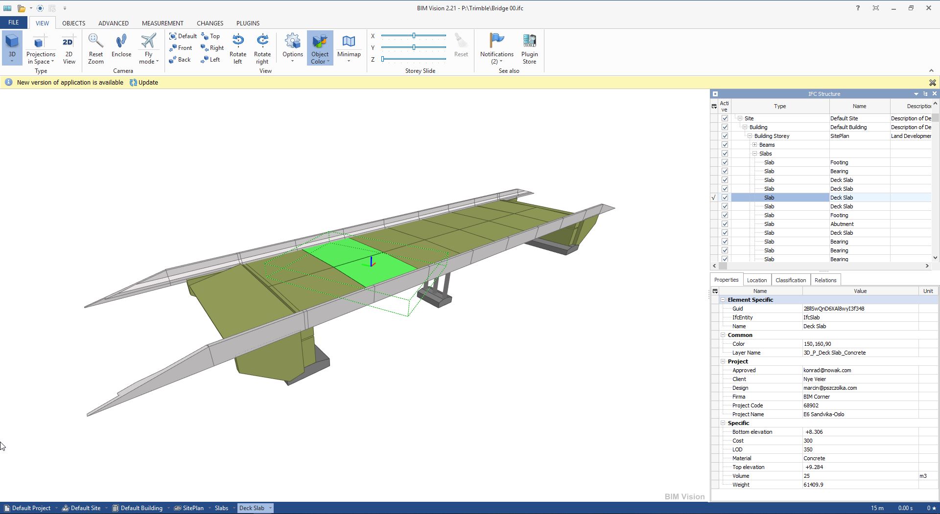
BIM Vision is a free desktop application from Datacomp company based in Cracow, Poland. The application allows you to view IFC 2×3 and IFC 4 files. The application provides the possibility of viewing the object from different perspectives, different sides. It is possible to set the transparency of an object. Non-geometric properties of objects are listed in the table. The great advantage is the fact that the properties are viewed on one page (here Common, Project, Specific). Also, we have a view on the classic IFC file structure
BIM Vision
SolibriAnywhereis a free desktop program from Nemetschek. The program supports the preview of IFC files. For some time now, you need to have an account on the Solibri website to use this solution. It features file viewing features available in other applications. The most popular are isolating objects, setting partial or full transparency, viewing the model from different perspectives. Properties assigned to an object are viewed in tabs (contrary to BIM VIsion). Individual properties are marked in blue (Common, Project, Specific).
Solibri Anywhere
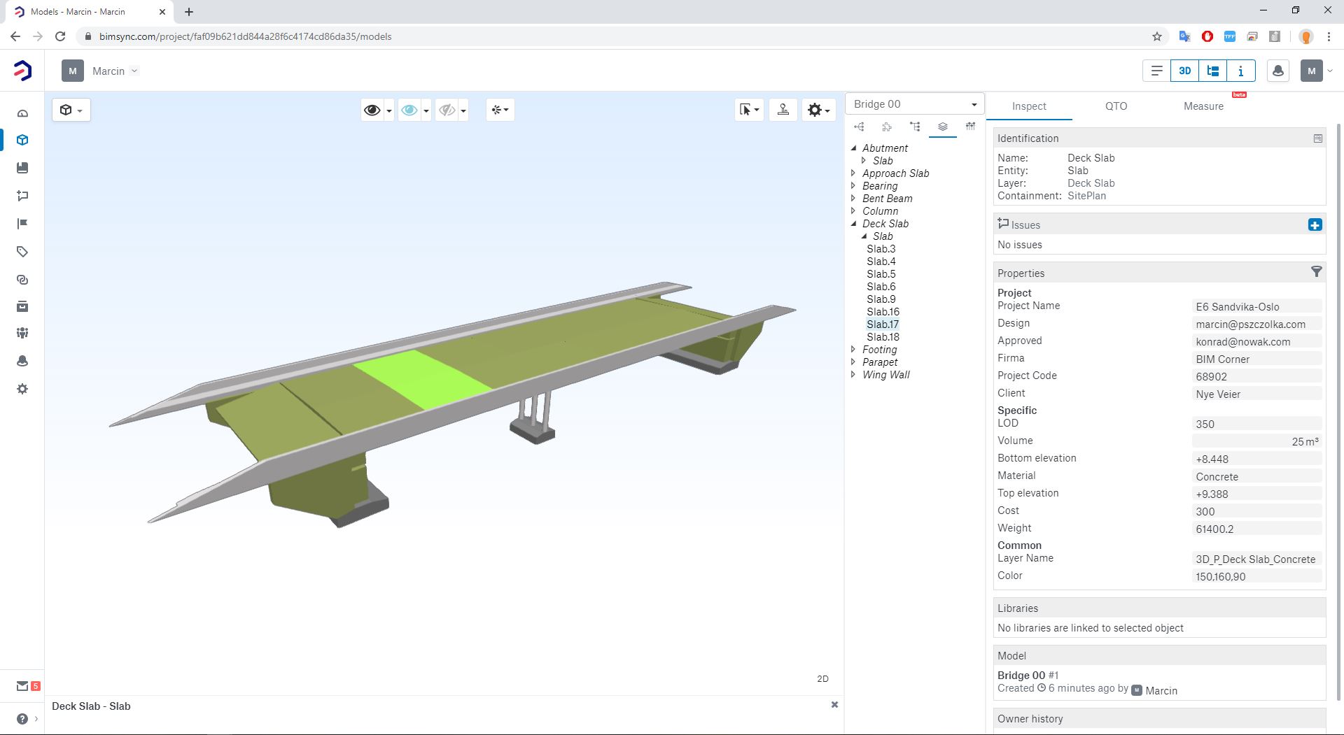
Bimsync is a paid browser software providing the ability to view an IFC file and information assigned to objects. Another advantage is that only user-defined IFC properties are available. It makes the file clearer and free of unnecessary data. As with Trimble Connect, BIMSync allows you to export the information contained in the IFC file to a CSV or XLS file.
BIMSync
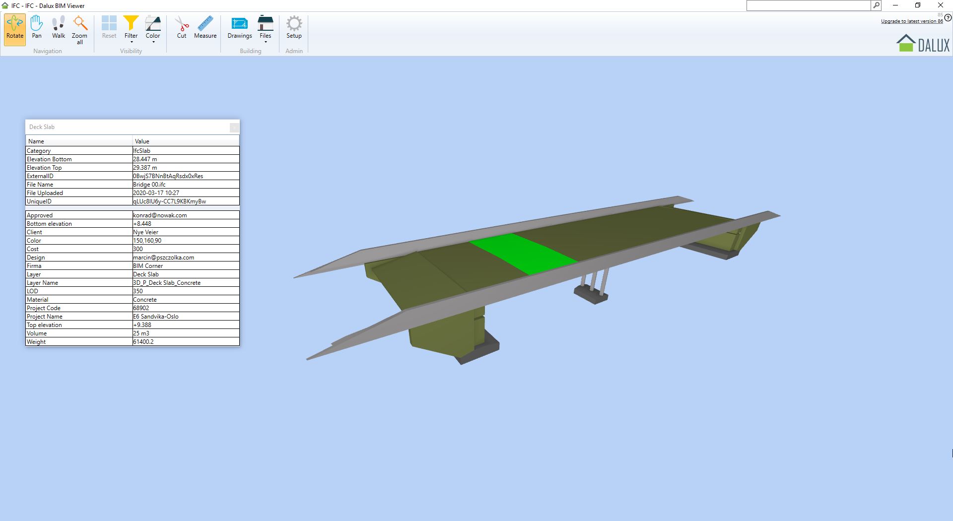
Dalux Viewer is a free program supporting IFC file viewing. It offers a very simple interface. The information attached to the object is displayed tabularly. There is no IFC division structure. The information is viewed without property division (Specific, Project, Common). The information is also displayed at the lowest level.
Dalux Viewer
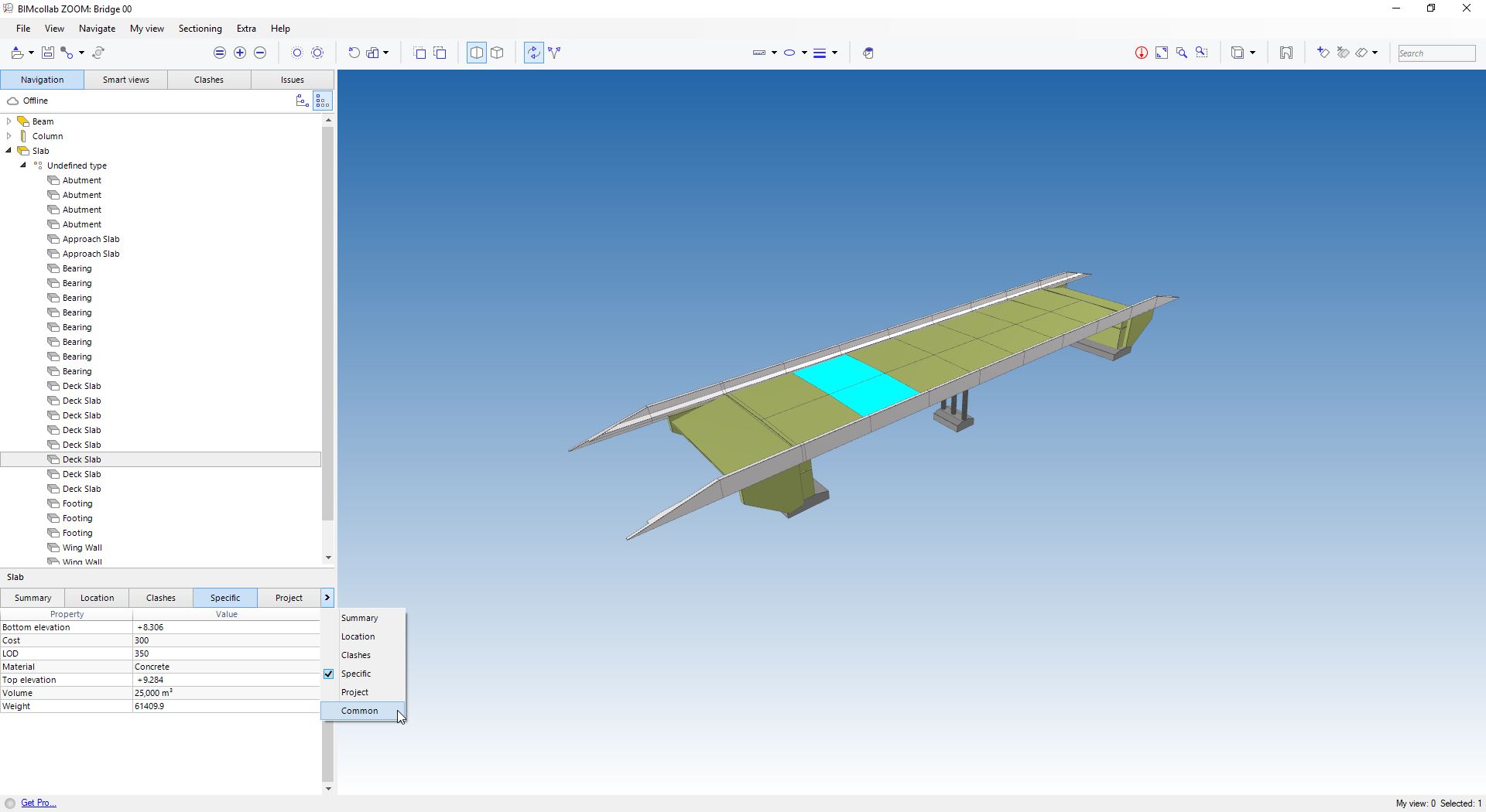
BIMCollab Zoom is a free software from KUBUS company. The information in the IFC file is viewed in a similar way to Solibri. Each property has its tab. The application provides a division structure of the IFC file. The program allows for different camera settings (Orbit mode, Fly mode), the possibility of isolating objects, changing object color and setting the transparency of objects.
BIMCollab Zoom
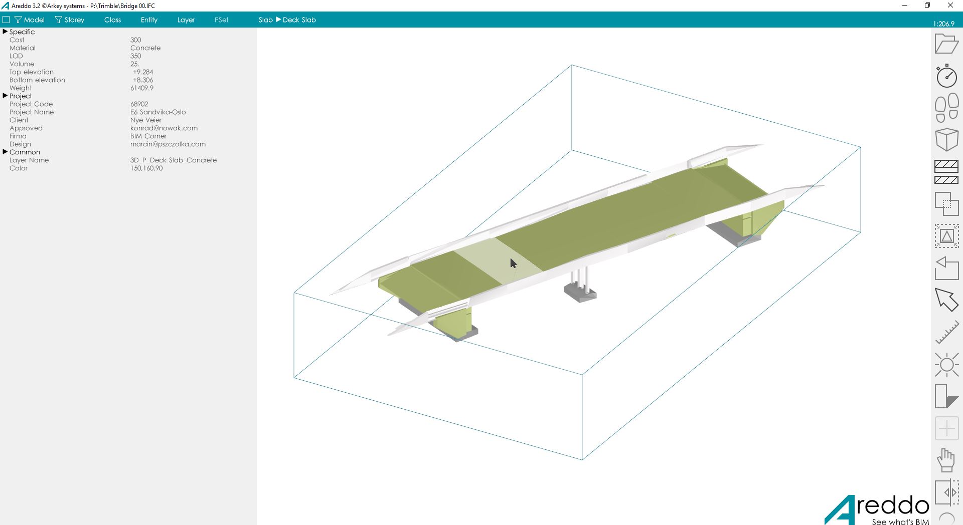
Areddo is a free BIM tool, the least popular of all the abovementioned. It is not capable of rendering 2×3 IFC models. In each previous application, the model was viewed neatly, whereas, in Areddo there was a problem with rendering 3D objects. It provides basic functions to support viewing of 3D objects and offers a tabular view of the information contained in the IFC file.
Areddo
BIM software for adding and editing information included in the IFC
A recurring issue when exporting an IFC file lies in the fact that despite the identical scheme, the data is exported in different ways, and the information is stored in different places. Currently, we have several tools to help solve the problem.
SimpleBIM is a paid desktop BIM software (€1250/year). The trial version for 30 days. Among many features, the program allows you to edit IFC 2×3 and IFC 4. The application allows you to add properties to a 3D object and edit the information assigned to the property. A set of properties should be created in a separate *.xlsx file and then imported. The information may be modified manually in the application. It is possible to export modified files to IFC 2×3 and IFC 4.
Simple BIM
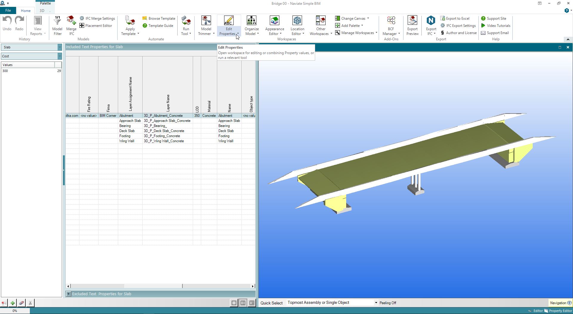
iConstruct is a paid BIM software ($3000/year) running as an Add-in to Naviswork. It includes the Append Data Tool, providing you with the option to add, modify, or delete a custom data file from IFC. The software offers the ability to group items or add custom data. You can edit the information on the tab (i.e., Specific, Revision, Genertal, etc.) defined by the user. The program allows exporting an IFC file.
iConstruct
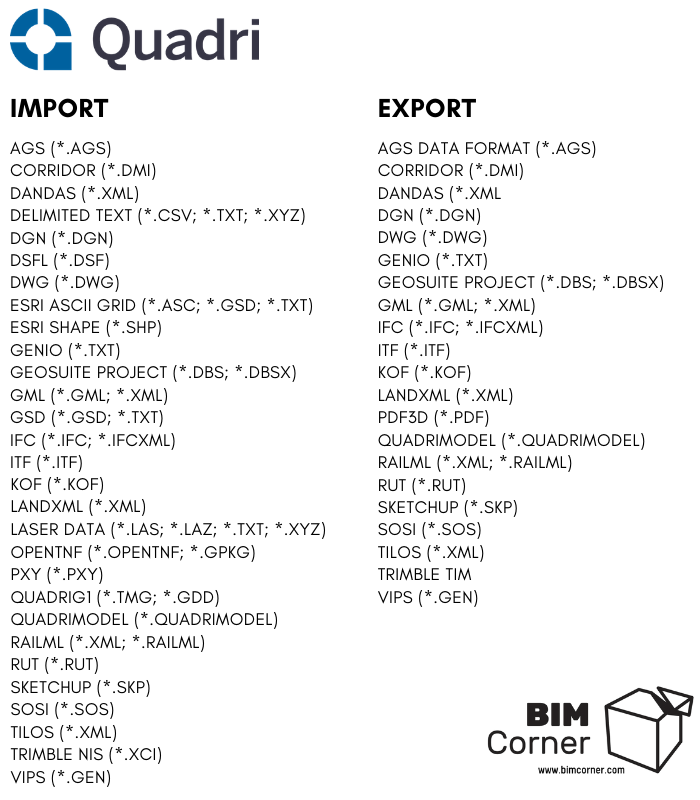
List of selected formats supported by Trimble Quadri
Quadri is the only BIM software on the list to view and edit multiple file formats. If you would like to present the file in visual form, it should be imported into Quadri. Quadri provides its object library. The objects include Bridge Part, Abudment, Road Bed, etc. The system aggregates files from different environments and presents them in one common standard. Quadri allows you to add information to a graphic object and then export it to different formats. We will focus on Quadri in the upcoming articles.
Trimble Quadri
It doesn't matter which BIM software you use. All that matters is the final result
As you may notice, there are many BIM softwares on the market. Thus there are programs for creating 3D models, viewing CAD/BIM, and editing files. I hope the above text has helped you to learn about new BIM software, you have not heard before. Notice that a successful BIM Coordinator is supposed to operate any software specific to each of these categories. For more software and different categories check this list.
If you liked the article, leave the comment, and describe your experiences with similar software. Tell us which BIM software and features you use the most.
The next article of this series will explain how we can import and export files to Quadri.
Did you like that post ? Share it with others !
We spend a lot of time and effort creating all of our articles and guides. It would be great if you could take a moment to share this post !
You have successfully joined our subscriber list. Check your inbox. Confirm email in order to get access BIM Case Studies from the biggest Norwegian projects.
Reasons to Subscribe to the BIM Corner List:
BIM CASE STUDIES
After reading this guide, you will learn:
How BIM is used on the biggest projects in Norway
What were the challenges for the design team and how were they solved
What were the challenges on the construction site and what was our approach to them
News From BIM World
Every Thursday you will get a package of news and useful links from the BIM world.
No Hype
Just real content that’s meant to make a difference in your BIM knowledge.
This site uses cookies to offer social functions, analyze traffic and conduct remarketing activities. Details can be found in the privacy policy (info button).


BIM crossway software can someone update me on this
I truly appreciate your post. Great site!
BIM software training Hyderabad | 5D BIM Training Course
This article was extremely interesting, especially since I was searching for thoughts on this subject last Thursday.
Revit MEP course training in Hyderabad | Revit MEP Software Course
perfect
thank you for a very good article