
Raw data, basic data, input data, master data. There are many terms for BIM documentation containing a description of the existing situation. One thing is sure. Accurate and reliable reflection of the existing situation gives a great advantage at the design phase.
Therefore, it is worth knowing the types they divided into, what elements are included, and also what to pay attention to when preparing the input data. Enjoy the next part of the series dedicated to organizing BIM knowledge in the infrastructure industry, based on the Norwegian manual for modeling infrastructure objects V770.
I hope the following study will help you avoid any project deviations caused by outdated or incorrect input data.
This post is a continuation of the series START FROM BEGINNING – BIM IN INFRASTRUCTURE . The first post from the series is available here: “BIM Objects in Infrastructure”
Table of Contents
Input data is a collective term for documentation as a starting point for planning, design, and construction. Such data describes existing objects under and above the surface of the site in the area of the planned project, at a given time. In general, the input data reflects the current situation.
It is worth mentioning here that the input data may take a different form, for example, digital files from measurements, pictures from air raids, but also maps in a paper form (you can still find such data today).
Depending on the location and size of the investment, the quality of data may vary.
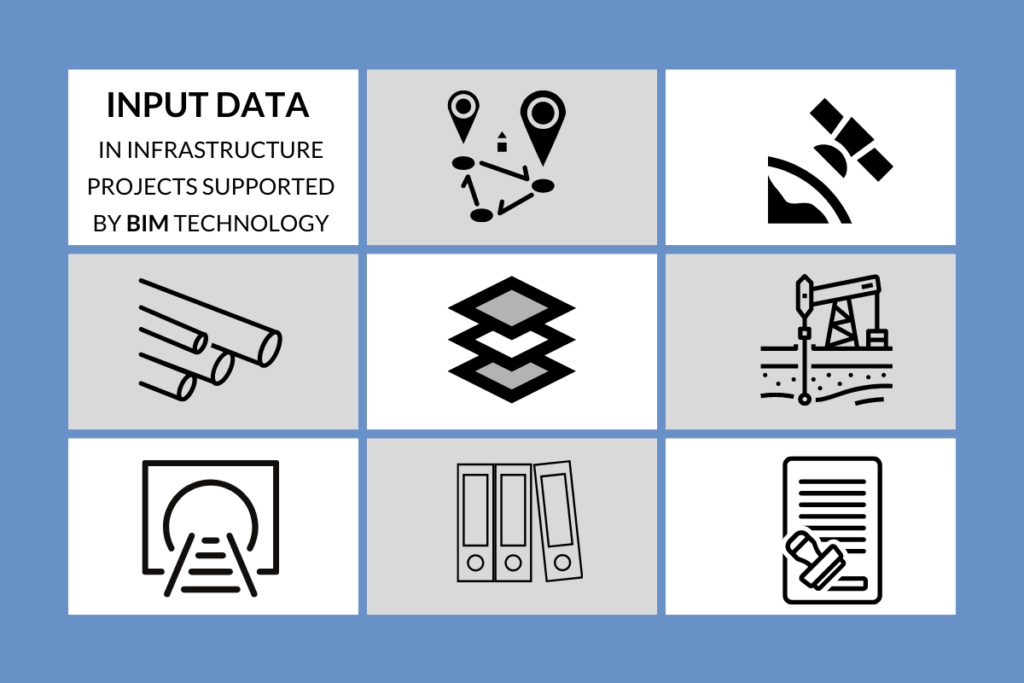
Let’s take a look at a typical input data in an infrastructure project.
1. Survey benchmarks
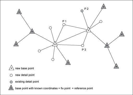
The geodetic control points, also called benchmarks, are geodesic signs of a certain ordinate of height in an adopted reference system. Points are used as reference points when carrying out geodetic measurements. In the construction phase, they determine a reference point for the layout of the work area, the layout of new objects, or as a reference to the machine control system.
Furthermore, the geodetic control points are used, among others, for:
- setting up clouds of points, photogrammetric and laser measurements
- measuring asphalt surfaces between an existing and a newly designed situation
- high accuracy during construction
2. Elevation data (Topography)
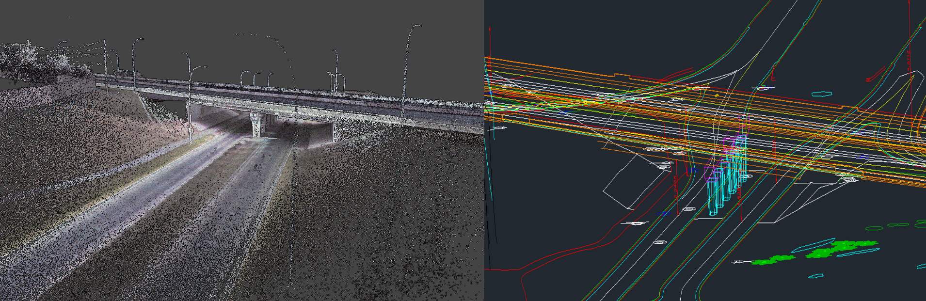
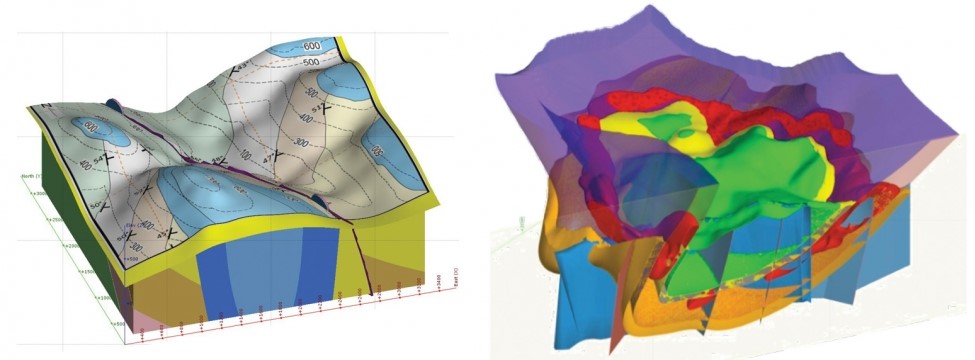
The elevation data, as the name suggests, describes the elevation of the existing terrain above and below the water level. Data of this type can be, for instance, a cloud of points, measurement data from geodetic instruments, or contour plan. The elevation data serves as a starting point for the surface area. The best terrain mapping results from the cloud of points, however, it is important to remember that these are often huge files containing raw unprocessed data. The ideal solution would be data in the form of a grid of DTM triangles.
3. Underground utilities
The data describing the existing underground utilities networks is the nightmare of each BIM Coordinator. In most cases, the data is the least accurate and has an approximate location. It happens that the institution responsible for the network does not have digital data. Thus, it is common practice to order additional measurements in the field. Some instruments allow determining the exact position, one of them is, for instance, ground-penetrating radar. However, it is still a technological innovation in the construction industry.
What data we are talking about:
- Electrical network:
- cables, cable trays (high voltage, low voltage, and other)
- electrical pit
- constructions
- Water supply systems:
- pipes of all types (drain pipes, sewage pipes, heat pipes, and other)
- inspection chambers
- Underground constructions:
- foundations
- bottom of the foundation wall
- stakes, slurry walls, ties
- tunnels, garages, and other

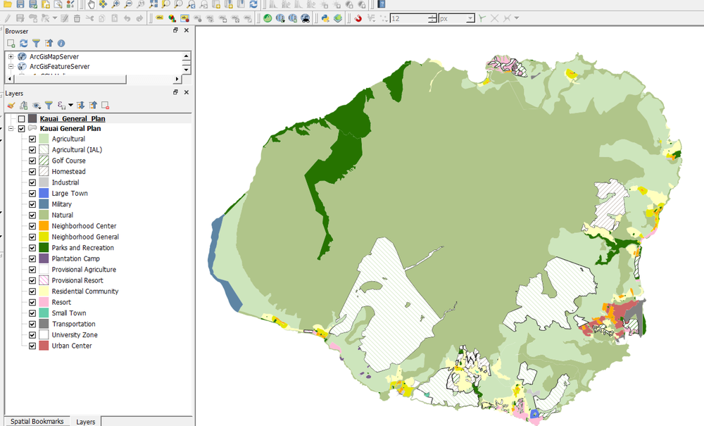
4. GIS data
GIS (Geographic Information System) data or thematic data describes physical and non-physical objects above and below the terrain. In the context of the infrastructure investment and its impact on the existing areas, such data is valuable. GIS data includes a set of thematic data, such as land development plan, topography, hydrology, woodland, agricultural areas, etc.
More GIS data:
- road network,
- underground installations,
- ground conditions,
- buildings,
- property boundaries,
- land use,
- polluted sites,
- cultural heritage objects
5. Ground conditions
“Underground layers” data type describes the bedrock, soil, and groundwater under the surface. As in the case of underground networks, the data acquired here also requires additional measurements. Geological boreholes are recommended. It should be noted, however, that such individual boreholes are often located several dozen or even more meters apart. Thus, the model of underground layers in 3D is burdened with an error. In the case of larger investments, more accurate data is advised.
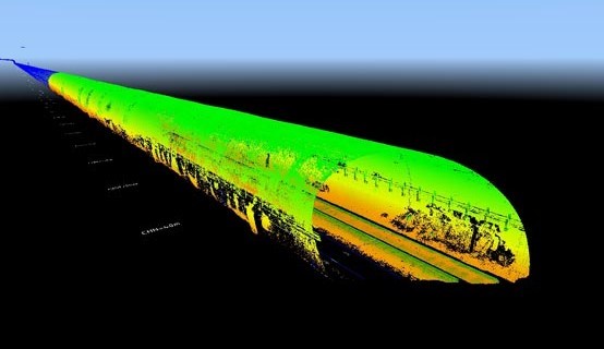
6. Tunnels data
In mountainous countries, especially in Norway, this is common data. Such data shows the existing tunnels and the mountain surrounding the tunnel. A cloud of points is the most common form of data.
7. Documentation from previous project phases
In each subsequent phase of the project, the documentation created in the previous phase becomes the starting point. For example, the documentation from the planning phase of a corridor study is the documentation used as a foundation for the construction documentation. The quality of the input data is often lower, although the documentation gives us a great idea of what has been done. These can include output data, models, drawings, reports, photographs.
8. Other plans
Other plans, documents that may be useful. For example, the UrbanDevelopment Plan, Planned Investments
In infrastructure projects where BIM is used, the BIM Coordinator is responsible for the quality of the input data. However, in this area, the Coordinator works in cooperation with discipline responsibles. In the case of data such as utility networks, the industry has a better overview of what is available and what additional measurements should be taken. The BIM Coordinator’s task consists of ordering, downloading, and converting the data into a suitable format to provide the industry technician with the material to work with.
In Norway, the data is stored in different reference systems depending on the owner. For example, network owners use their data for maintenance. Such data is stored in the UTM system, which covers a larger area of the country (4 areas in Norway). Whereas the design of new objects is carried out in the NTM system, which is more accurate (in Norway 24 areas). Thus, one of the tasks of the BIM Coordinator involves transforming the data into an appropriate reference system. Lack of data transformation may result in costly deviations at the construction phase.
The good practice is to save all the data that goes into the project in a simple Excel spreadsheet. With a large number of files, you can avoid a situation where, for example, the data is lost or reordered. Such a spreadsheet can be sent to industry professionals who can create a list of missing data.
Depending on the data type the format may vary. In Norway, the most common input format is the SOSI format, mentioned here:
http://bimcorner.com/bim-object-in-infrastructure/
The elevation data, containing the topography in the form of a grid, are supplied in the LandXML format. Clouds of points in XYZ and LAS formats. GIS data in SOSI and SHP format. Benchmarks are provided in the KOF format. The orthophotomap is saved in ECW or TIFF format. More about BIM formats here:
http://bimcorner.com/the-best-bim-format/
The BIM Coordinator’s role includes bringing all formats used in the project into one common format. Usually, it is the DWG or DGN format, which can be opened in many programs.
Each file delivered to the project should clearly indicate what type of data it contains. However, the project may have its own nomenclature. I would like to present how it is suggested in the V770 manual. The naming is based directly on the type of data you can read about above.
So how should I name a file containing a particular type of data?

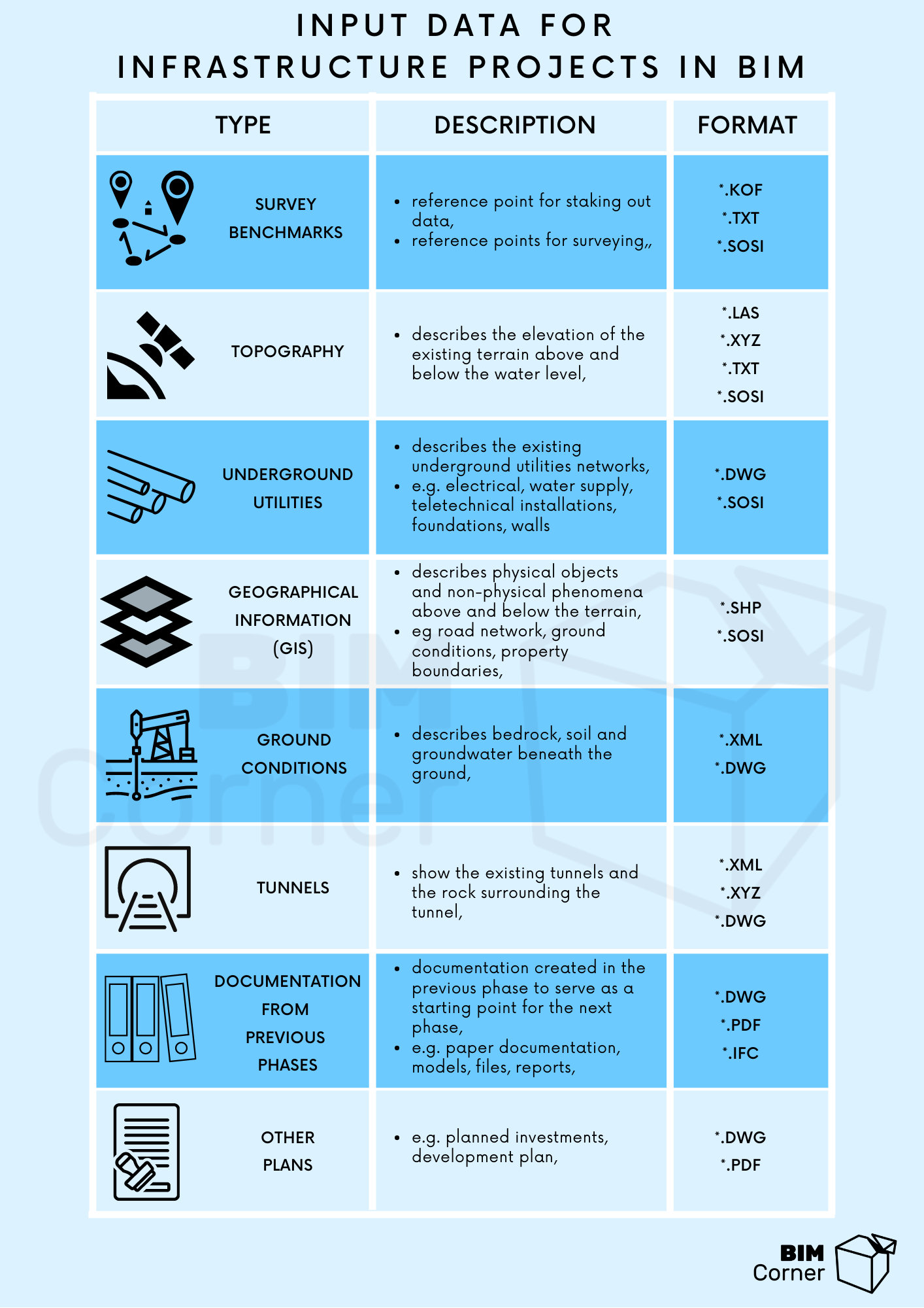
I would like you to remember from this post that the input data is as important as the BIM models. Their accuracy affects the quality of the project. To make it easier for you to remember all types of data, I have prepared an infographic that you can print and hang above your desk.
Let me know if this list was useful to you.
Finally, I would like to invite you now to the next posts about BIM in Infrastructure.
I’m just getting started 🙂


This is a really great overview of diverse range of data involved in infrastructure projects. I don’t suppose you’d consider adding *.DGN in places where you have *.DWG given its prevalence on these sorts of projects?